UPDATED:
05/25/2024 10:06 AM
Key Details
Property Type Vacant Land
Sub Type Residential
Listing Status Active
Purchase Type For Sale
Subdivision Upper Whittemore
MLS Listing ID 2000870
HOA Fees $80/mo
HOA Y/N Yes
Annual Tax Amount $1,532
Lot Size 3.480 Acres
Acres 3.48
Lot Dimensions 332.0x456.0x333.0
Property Description
Location
State UT
County Utah
Area Provo; Mamth; Springville
Zoning Single-Family
Direction I-15 to Springville exit # (Wal-Mart) Go East on 400 S. At 200 East 400 South (Traffic Light/Art Museum) set trip odometer on 0. Continue East on 400 S. until the roundabout at the top of the hill. (1 mile). At the round about take first right onto Canyon Rd. (1200 E.) When the odometer reads 3.8 miles you will see the Reservoir/Dam. Just past the golf course, there is a fork in the road. 6.1 miles. Take the Left Fork (past Rotary Park). Continue up the road for approximately 5 miles. At 10.5 miles you will come to a River rock estate home on your right (Legacy 641 sign) As you pass this home there is a sharp bend in the road. As the road straightens on your left is a graveled parking area with a fence(10.7 miles) Turn left here Upper Whittemore Rd. The road will be Asphalt then will turn to dirt. (11.4 miles) Continue up the road you will come to a gate. (11.85 miles) Boundary line for Upper Whittemore. The gate is locked for security. Continue up the road. At 12.1 miles there will be a split in the road . G
Interior
Fireplace false
Exterior
Utilities Available Natural Gas Not Available, Electricity Available, Power: Not Connected, Sewer Not Available, Sewer: Septic Tank
Waterfront No
View Y/N Yes
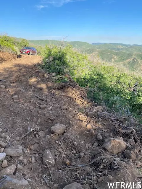
View Valley, Trees/Woods
Present Use Residential,Recreational
Topography Terrain: Grad Slope, Terrain: Mountain
Private Pool false
Building
Lot Description Additional Land Available, Terrain: Grad Slope, Terrain: Mountain, View: Mountain, View: Valley, Wooded, Excl. Mineral Rights, Excl. Oil/Gas Rights
Faces North
Sewer None, Septic Tank
New Construction No
Schools
Elementary Schools Hobble Creek
Middle Schools Springville Jr
High Schools Springville
School District Nebo
Others
Senior Community No
Tax ID 57-006-0011
Acceptable Financing Cash, Conventional
Horse Property No
Listing Terms Cash, Conventional
GET MORE INFORMATION


